BRANTINGHAM PARISH COUNCIL
  • Home
    • Privacy Policy
  • About
    • History
  • Conservation Area
  • Councillors
    • Parish Clerk
  • Meetings
    • Archive >
      • 2022
      • 2021
      • 2020
      • 2019
      • 2018
      • 2017
      • 2016
      • 2015
      • 2014
      • 2013
      • 2012
      • 2011
      • 2010
  • PLANNING
  • Accounts
  • Information
    • Emergency Services
    • ERYC & Neighbouring Parish Councils
    • Help & Advice
    • ​Local Hospitals, GP Surgeries & Dentists
    • Local Schools, Pre-Schools, Nurseries & Libraries
    • Utilities
    • Walks
    • Waste Collection Calendar 2021 - 22
    • Newsletters
  • Photographs
  • Guestbook
  • Contact

About

Picture
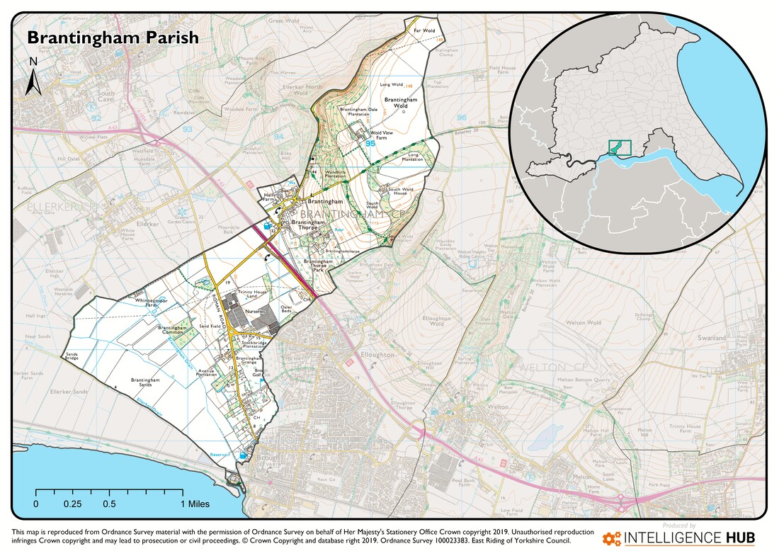
With a population of around 400, Brantingham is a small, former estate village and civil parish in the East Riding of Yorkshire, England. Situated a little inland north of the Humber Estuary, 12 miles (19 km) west of the city of Kingston upon Hull, the village nestles at the southern end of the Yorkshire Wolds. With its picturesque rural location, good transport links and only about 70 houses in and around the village, Brantingham is a sought after place to live. Many of the houses date from the 18th Century and are built from locally quarried limestone. With limited and mainly sympathetic development over the years and a mix of fine houses and quaint cottages, most of the village is now designated a Conservation Area. i.e., "an area of special architectural or historic interest, the character or appearance of which it is desirable to preserve or enhance".
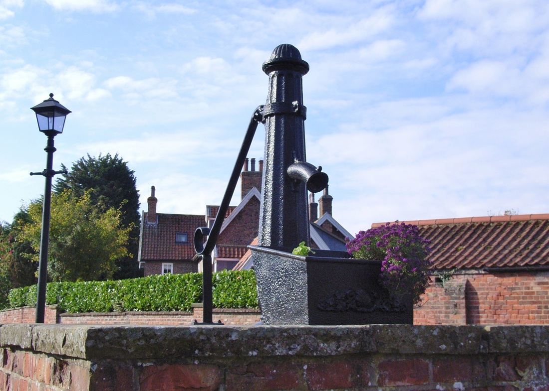
The quiet rural setting and stunning scenery makes Brantingham and the surrounding area very popular with walkers, cyclists and horse riders. The hilly nature of the landscape make several routes moderate to challenging. One local landmark is "Spout Hill", named after the old cast iron water spout at its bottom. The narrow road up the hill is one of the steepest in the area, rising nearly 100m in less than a kilometre. Local sports teams and army cadets are known to train by running up and down it. The top part of the road acts as a link between two public footpaths which form part of the Yorkshire Wolds Way, a National Trail that stretches 79 miles (127 km) from Hessle, west of Kingston Upon Hull, to Filey on the North Yorkshire coast.
Learn more
Picture
Privacy Policy
Copyright © Brantingham Parish Council 2015 - 2023        
All photographs are the property and copyright of their respective owners. With the exception of the Bygone Days Album, or unless otherwise attributed, all site photography is 
© Richard Powell & © Dani Wilkinson

Picture
  • Home
    • Privacy Policy
  • About
    • History
  • Conservation Area
  • Councillors
    • Parish Clerk
  • Meetings
    • Archive >
      • 2022
      • 2021
      • 2020
      • 2019
      • 2018
      • 2017
      • 2016
      • 2015
      • 2014
      • 2013
      • 2012
      • 2011
      • 2010
  • PLANNING
  • Accounts
  • Information
    • Emergency Services
    • ERYC & Neighbouring Parish Councils
    • Help & Advice
    • ​Local Hospitals, GP Surgeries & Dentists
    • Local Schools, Pre-Schools, Nurseries & Libraries
    • Utilities
    • Walks
    • Waste Collection Calendar 2021 - 22
    • Newsletters
  • Photographs
  • Guestbook
  • Contact